


Weather can look perfect from the marina while conditions farther offshore tell a completely different story. Wind direction, wave height, swell period, and changing tides can turn an easy trip into an uncomfortable one. Checking these conditions before departure gives boaters a much clearer idea of what to expect.
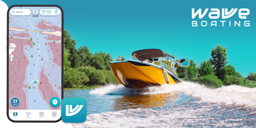
Using a wave height app can make this information easier to understand before choosing a departure time or route. Wavve Boating, for example, provides hourly wave-height information, wave-period data, and seven-day forecasts directly alongside marine navigation charts.
Why Wave Height Matters
Wave height describes the vertical distance between the trough and crest of a wave. It is one of the most useful pieces of information for understanding what conditions may feel like once you’re away from protected water.
Larger waves can affect:
- Passenger comfort
- Boat handling
- Cruising speed
- Fuel consumption
- Visibility from the helm
- Safety on smaller vessels
However, wave height should never be considered by itself. Two forecasts showing similar wave heights can produce very different experiences depending on how frequently those waves arrive.
Pay Attention to Wave Period Too
Wave period describes the amount of time between successive waves.
A short wave period generally means waves are arriving closer together. This can create steep, choppy conditions that may be uncomfortable even when individual waves are not especially large.
Longer-period waves tend to be spaced farther apart and may create a smoother rolling motion.
Wavve provides both wave height and wave-period information so boaters can evaluate more than the size of the waves alone.
This distinction can be particularly important for smaller boats, personal watercraft, fishing boats, and anyone planning a longer coastal trip.
Wind Helps Explain What the Water May Do
Wave forecasts become more useful when considered alongside wind.
Wind speed and direction can influence how quickly conditions build and which areas become roughest. An exposed stretch of water may become uncomfortable while a protected shoreline remains relatively manageable.
Before leaving, check:
- Current wind speed
- Forecast gusts
- Wind direction
- Expected changes during your trip
Wavve combines multi-day forecasts with wave-height information and wind overlays, allowing boaters to consider these conditions alongside their planned navigation area.
Check Conditions for Your Return Trip
A common mistake is checking the forecast only for departure.
Suppose conditions are calm at 8 a.m., but you’re planning to return at 4 p.m. If wind and waves are forecast to increase substantially during the afternoon, your trip home could be very different.
Hourly forecasts make it easier to identify these changes.
Wavve’s wave tools provide hourly wave-height information as well as a seven-day outlook, which can help boaters choose better departure and return windows.
Boat Size Changes How Waves Feel
The same conditions do not affect every vessel equally.
A large cruiser and a small center console may experience identical waves very differently. Personal watercraft and small open boats can be even more sensitive to changing conditions.
Other factors also matter, including:
- Hull design
- Vessel loading
- Direction of travel
- Operator experience
- Passenger comfort
This is why a forecast should be interpreted in relation to your particular boat rather than relying on a universal definition of good or bad conditions.
Look at the Entire Route
Conditions at the marina do not necessarily represent conditions at your destination.
A route might begin in a protected bay, continue through an inlet, and eventually enter exposed coastal water. Each part of that trip can experience different wind and wave conditions.
Viewing forecasts directly on marine charts can make this easier to understand. Wavve integrates wave information with weather, tides, depth data, and navigation rather than treating each element as a separate planning tool.
This gives boaters more context when deciding whether to continue with the original route or choose a more protected alternative.
Longer Forecasts Help With Weekend Planning
Wave information is useful even several days before departure.
A seven-day forecast can help you compare potential boating days and identify periods that appear calmer. As the trip approaches, checking updated hourly information can provide a more detailed picture.
Forecasts will always contain uncertainty, especially several days in advance, so conditions should be checked again shortly before departure.
Never Depend on One Number
No single measurement can determine whether conditions are appropriate for your trip.
Wave height should be considered together with:
- Wave period
- Wind speed and direction
- Tides
- Weather systems
- Vessel capabilities
- Local marine advisories
Combining these factors creates a much more realistic picture of what you may encounter.
Final Thoughts
Understanding wave conditions before leaving the dock can make boating safer, more comfortable, and easier to plan.
Rather than checking wave height alone, consider how wave period, wind, tides, and your vessel’s characteristics interact. Wavve Boating brings wave forecasts together with marine charts, weather, tidal information, and depth data, giving boaters a more complete view of upcoming conditions.
Forecasts cannot eliminate every surprise on the water, but they can help you choose better departure times, more appropriate routes, and days when conditions better match your boat and experience level.